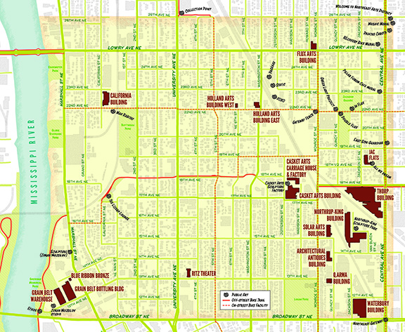
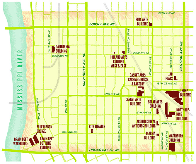
The Northeast Minneapolis Arts District commissioned Nat Case of INCase, LLC to design a series of maps to help define the Arts District both for people to find the Arts District and understand what is in it. We wanted to showcase the 18 arts buildings and how to find public art throughout the Arts District.
The whole shebang — Arts District Map
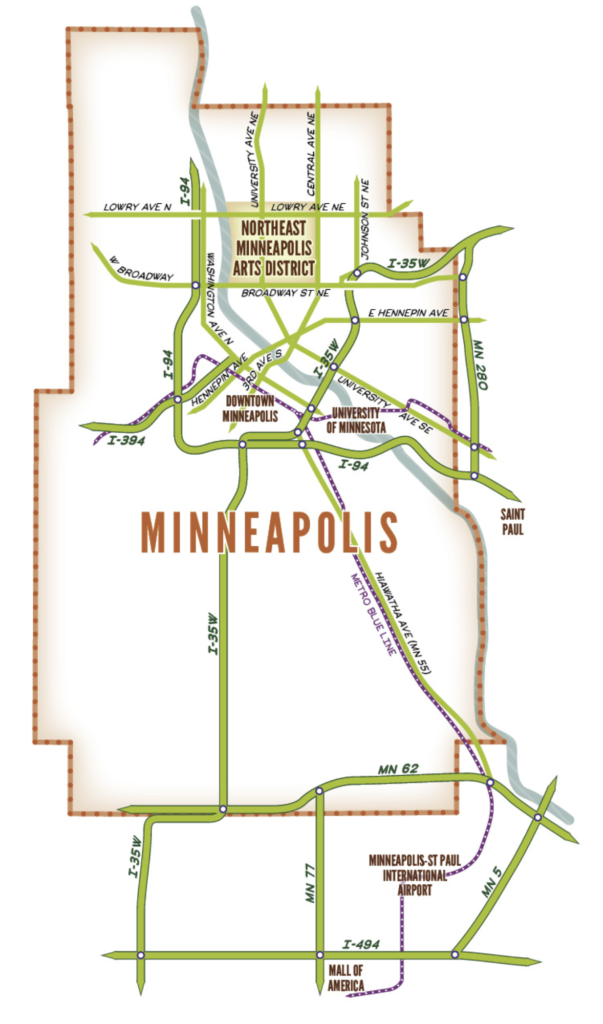
INCase, LLC was able to create a series of maps to help visitors find the AD from the Airport and from Downtown. InCase, LLC was able to include multiple ways to travel to and in the AD from biking, walking, public transit and driving (a special map shown toward the end of this article). One of the important parts of the map was to have a more up to date public art locator. We know a lot of people are looking to explore outdoor public art. The map above includes some of those features.
Eighteen Arts District Buildings highlighted map
We commissioned these maps to be tools for the AD to help bring more visitors to the AD from places like the MSP International Airport (see contextual map further below this article), as we will continue to have art exhibits in the Arts@MSP program for years to come. The Arts District board believes it is important to have our own maps to utilize and distribute to artists and businesses throughout the Arts District we expect will continue to build more reach for the artists in the community.
We encourage artists and businesses to download these maps for your use on your websites to continue to build awareness of the Arts District, where it is and what is in it.
Downtown access map
You may wonder why we need a map like this to be created. Our rationale is that when people who have never visited the Arts District find our website then they can truly visualize its size and scale. When we tell people there are 18 art buildings and 1200 plus artists it can come off as an abstract idea that they just can’t visualize – are they all packed into a walkable superblock? No, it’s more like a sprawling square-mile campus. With these maps we are working to create a more tangible tool for the arts community to utilize. These maps will be used as part of the Welcome Center in large format 8’x 8’ for visitors to view.
From the Airport to the Arts District
Boundaries of the Arts District map. Download each one for your website.