
Using Geographic Information Systems software and publicly available data, University of Minnesota grad student intern Kenny Niemeyer created this version of our signature map, showing the locations of Arts Insights advertisers.
Since 1984, industrial land use in Minneapolis has been converted and developed for other uses. Across the entire city, the acreage of industrial land use reduced by 41% from almost 5,000 acres to just 2,900.
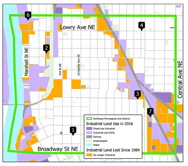
The above Northeast Minneapolis Arts District map highlights in orange land which had industrial use in 1984 and had changed to a use other than industrial as of 2016, the most recent data available. Over those 32 years, industrial land in the Arts District (outlined in green) went down by 53% from 228 acres to 106. The Arts District is studying the effects of the industrial land being repurposed at the expense of opportunities for artist and maker space. A full report will be available in September.