
University of Minnesota graduate student Kenny Niemeyer is interning with the Northeast Minneapolis Arts District this summer cataloging the land uses, talking with building owners and exploring ways to preserve maker space and compatible industry. Using Geographic Information Systems (GIS) Mapping, he created this version of the map readers usually see, showing the locations of the entities that advertise on the Arts Insights page in the Northeaster newspaper.
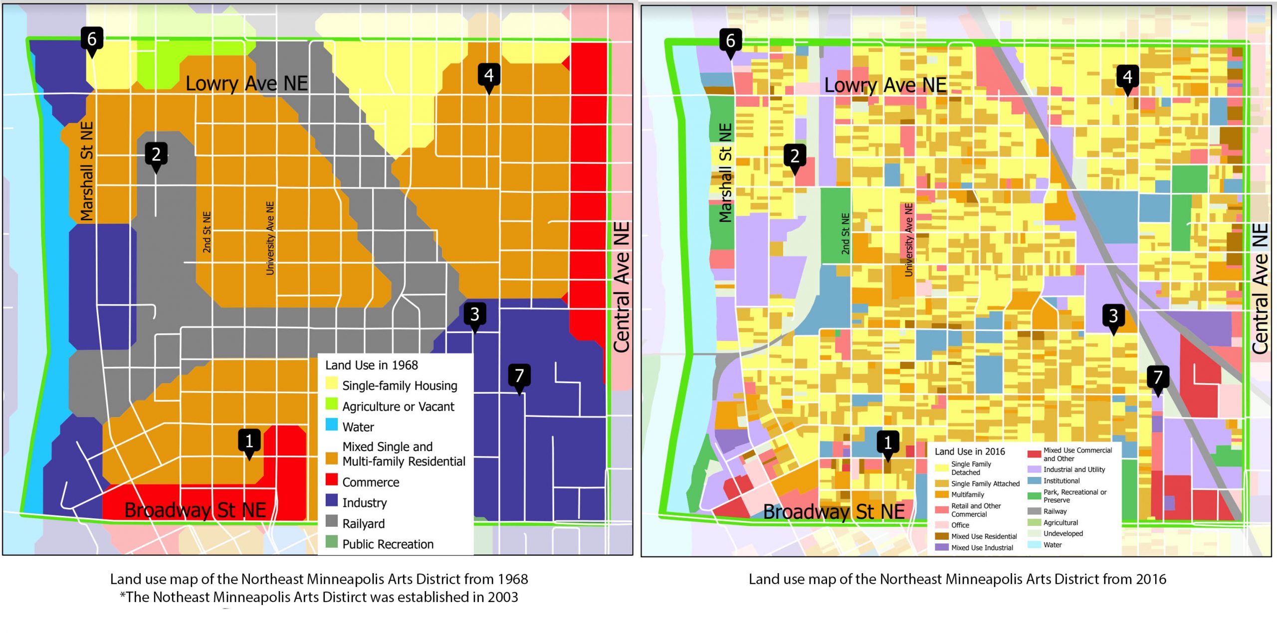 The map shows land use in 1968, scanned and digitized from a physical map created by the Metropolitan Planning Commission. Land use categories in Minneapolis were established in 1962 and remained mostly unchanged until 2000 when categories were significantly expanded.
The map on the left is the same area of land use of the Northeast Minneapolis Arts District in 2016. The dramatic changes of the land use are what Mr. Niemeyer is researching for the Arts District to understand what industrial zoned land is left and how we can preserve the zoning for artist maker space for the future. This is an early snapshot of what he is finding. By later this fall we will have a full report.